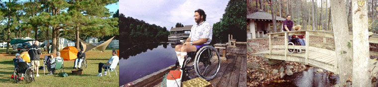


Shenandoah Valley Accessible Trails
Front Royal
Limberlost Trail
Link to trail map in PDF format.
Description: At milepost 43 of the Shenandoah National park, this 1.3-mile gently sloping loop is wheelchair-accessible with a greenstone surface. It passes through forest and mountain laurel and crosses over a 65-foot bridge and a 150-foot boardwalk. The park has added benches and over 20 resting areas along this trail.
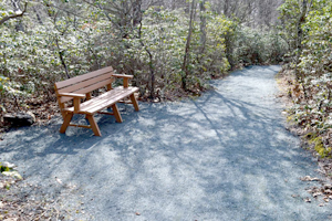
Benches along the Limberlost Trail.
Photo courtesy of the National Park Service
The trail provides numerous opportunities for wildlife watching, not the least of which is the almost fearless white-tailed deer grazing all around. The higher elevation of this area provides for exciting birding as well.
Directions: From Front Royal, VA, the Skyline Drive travels the entire length of Shenandoah National Park. Mile markers are placed along the right-hand side of the road heading south. The parking lot is located around mile marker 43 in the central section of Shenandoah National Park.
Additional Information: The information board at the beginning of the trail goes into great detail about the grade/slope of this trail as well as where the 17 benches are. There is no bathroom and no drinking water available.
Roanoke
Hanging Rock Battlefield Trail
Description: Just outside of Roanoke in Salem, this asphalt and concrete trail is slightly less than 2 miles in length and was the site of a Civil War raid, which is marked by monument along State Route 311.
Beginning at Hanging Rock, the trail meanders along Mason Creek and Kessler Mill Road and it’s a pleasant short walk through the Roanoke Valley's beautiful woods. There is a convenience store and gas station next door to stock up on provisions, but this trail isn’t long enough to need supplies. You’ll go under Interstate 81, arrive in Salem where the trail winds through a residential area, and houses until you reach the trail end at Timberview Road.
Directions: To get to the Hanging Rock trail beginning from Interstate 81, take Exit 141 (State Route 419 toward Salem/New Castle). Turn north onto SR 419 and continue on SR 311. The parking area for the Hanging Rock Battlefield Trail is on the left, next to the parking area for the convenience store, or across SR 311 at the monument.
If you are alocal and want to start at Timberview Road and go to Hanging Rock, gp south on SR 419/N. Electric Road for about 1 mile and turn right onto Dalewood Avenue. Take the first left onto Garst Street. Turn left onto Kessler Mill Road and drive 0.5 mile to the parking lot on the right.
<<<back to Accessible Trails
Home | Regions | Virginia Weather & Maps | Resources | Outdoor Recreation | About Us | Contact Us | Accessibility Links

